The Isle of Arran: Auchagallon Cairn, the King's Cave and Drumadoon Point
Not for from Machrie Moor is an unusual and enigmatic monument known as Auchagallon. Rather like the diverse forms of the more famous sites nearby, this sites has an unusual combination of cairn and stone circle. The antiquity of the central mound, at least as it appears today, has been questioned. The sandstone blocks of the circle appear embedded within this feature, but it is possible they were once freestanding. Intriguingly, the monoliths are graded in height towards the south-west (and towards the sea), which recalls recumbent stone circles and Clava Cairns in the north and east of Scotland. This might seem eccentric, but we must remember that ‘types’ of monument are, in part, a result of modern classification and may have been understood quite differently to their builders.

Above: Auchagallon Cairn overlooks the Kilbrannan Sound, with the Kintyre beyond (Photo: Aaron Watson)
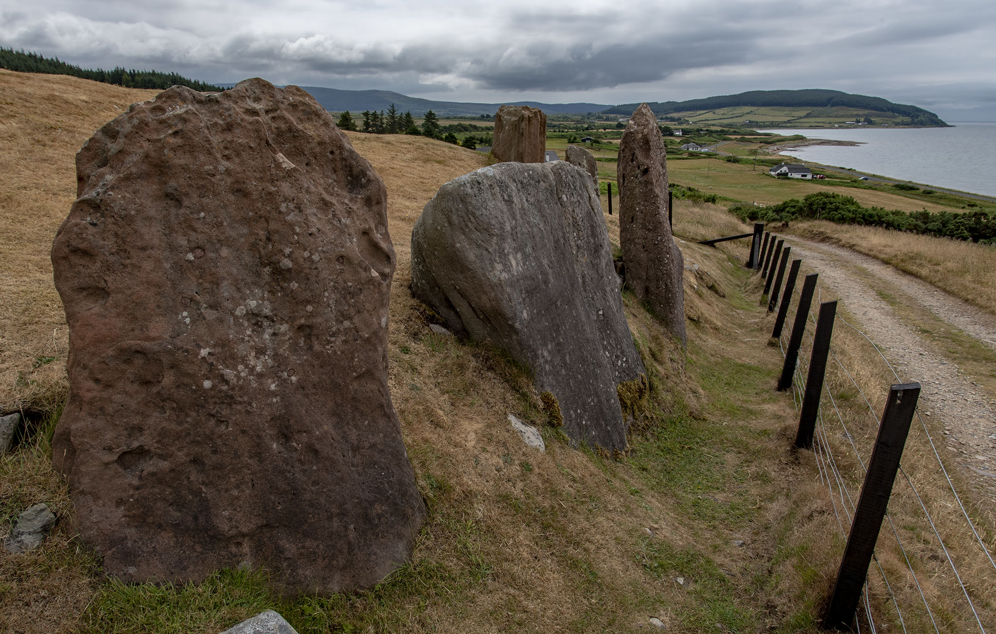
Above: The largest red sandstone monoliths at Auchagallon (Photo: Aaron Watson)
Along the coastline a short distance from Auchagallon Cairn is the King’s Cave, a cavern noted for its early medieval carvings. The coastline nearby is a location where pitchstone occurs, and I spotted many pieces where the ground was broken and eroded. Like all the other occurrences of pitchstone across Arran, we can only speculate as to whether this was a location where it was collected by people in prehistory.

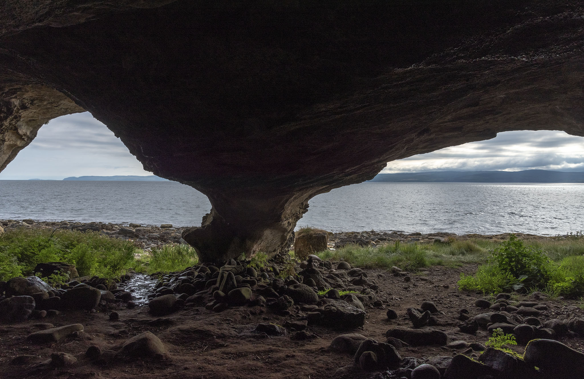
Above: Caves on the shoreline (Photos: Aaron Watson)

Above: Looking south along the coastline towards the conspicuous feature of Drumadoon Point (Photo: Aaron Watson)

Above: The stunning coastline near the King’s Cave (Photo: Aaron Watson)

Above: An intrusive volcanic dyke revealed in the intertidal zone. Today we have a geological explanation for these features. What might people in the Neolithic have thought? (Photo: Aaron Watson)
On the walk to Drumadoon Point, I encountered slabs of rock which contrasted between red and white. It has been noted by archaeologists that these colours occur often in the Arran landscape, and were embodied in the fabric of the megalithic monuments constructed there.

Above: The striking colours revealed on the shoreline (Photo: Aaron Watson)
Not far beyond the coloured rocks, the cliffs of Drumadoon Point rise vertically above the shoreline. They are jointed into vertical columns and very distinctive.


Above: The columns of Drumadoon Point make this feature look architectural (Photo: Aaron Watson)
The headland is the location of a fort, but its dating is uncertain. The significance of this landscape certainly extended back to the monument builder. A grey standing stone was set upright near the top of the headland, and Neolithic Grooved Ware pottery has been found nearby.

Above: The high ground defined by cliffs seems to have been significant for thousands of years ago (Photo: Aaron Watson)

Above: The standing stone on Drumadoon Point, with views looking along the coast to Blackwaterfoot (Photo: Aaron Watson)